
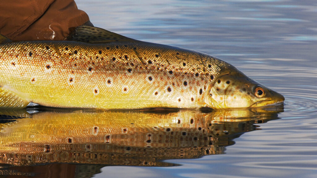
Tasmanian fly fishing: Western Lakes brown trout (image by Todd Moen)
The Tasmanian trout season is two week’s old, and the fishing has got off to a great start. We’ve had a welcome wet winter, meaning the fished spawned early and have had the chance to put condition back on throughout winter. Hydro Tasmania is reporting the highest lake levels in more than a decade, which is music to our ears.
Opening week fish condition
During the off season we took the opportunity to visually survey average fish size and age classes in a couple northern rivers, with early spawning aggregations triggered by late April rain. What we found was amazing, with three different spawning redds each holding three or four fish over five lbs, and a dozen or so smaller 12 inch trout. What this tells us is that the fish that survived the tough cormorant and drought years from 2023-2025 are now large dominant fish, and the healthiest you’ll ever find. I’m just not sure how we are going to stop them from braking us off in the small streams, but that is a great problem to have. RiverFly guide Andy Collings managed to land one of them in a twigwater last season, weighing close to eight pounds, whilst we had customers break off three over the six pound mark in timber. It is a catch-22: with the low and clear flows of the past few seasons, we improved our catch rates by using fine tippets and droppers, but on the flipside this leaves little leeway to put the brakes on big fish.
Around the fisheries
It has been great to see the feeders creeks off to a great start (small browns on the dries). Some of the classic Tasmanian lakes are also back from some tough years: Little Pine Lagoon has produced some great early morning fish, while the 19 Lagoons is producing some of the fattest wild browns in Australia (our hint: target the sand and silt bottomed water during spring frog season). Yet again these great starts are due to the good winter rainfall in Tasmania, combined with lower fish competition after the past couple of lean years with high predation and low summer water levels.
Brumbys Creek
Brumbys Creek is a favourite of mine, and one of the iconic Tasmanian fisheries. With kilometres of fishable public water, 30 minutes from Launceston, it is also an important fishery for the community. Did you know that Brumbys Creek also makes up the majority of the South Esk River flows during summer, meaning it is the largest contributor to Launceston’s iconic recreation area, Cataract Gorge. For me, this makes it the most influential waterway in northern Tasmania, based on community and economic benefit. Despite its importance, Brumbys Creek has had two poor years due to lack of flows and associated planning. Signs are good for a rebound season this year with good water levels in Great Lake. It’s also been very positive to have Hydro Tasmania and the Inland Fisheries Service acknowledge the issues, and begin working together to deliver a stable fishery with the world class sight fishing and excellent water quality that it is famed for. I look forward to providing some updates from the working group over the next month, but if we reach medium flow rates around mid to late October (measring 0.30cm or better on the blue line in this link ), then I’m expecting some excellent stick caddis feeders, and the chance the chance for a once in a lifetime brown trout in terms of size.
Early season exploration: Up Western Creek Track, and down Higgs Track (via Lady Lake Hut)
I like to go on a Western Lakes walk for opening weekend, and this season was no different. The north of the plateau is my favourite, although the extra elevation (~1200) means there is a chance of wilder weather than down at the 19 lagoons (~1050m). This years hike was up the Western Creek track, past Weston Lake and Lake Lucy Long, then off the plateau via Lady Lake hut and Higgs Track. For those thinking about walking in the area, it involves close to 500 metres of elevation gain too and from the carpark, and it is quite steep but spectacular. Western Creek track is by far the hardest track of the two, and is catagorised as a maximum difficulty ‘5’ by the Parks and Wildlife Service: this means it is tough walking, the track can be easily lost, and there are objective hazards such as sharp drop-offs (aka cliffs!) to avoid. The forest itself is beautiful, passing through wet eucalypt and rainforest, and includes a handful of waterfalls, along with pencil pine, king billy, and hybrids along the 2.5 hour walk up. Higgs track is quite different in character, and much more accessible: the track is built using rock from the area and old track building techniques brought over from Scotland. Originally a stock and sheep track, the track is still very steep (walking sticks are hugely useful), but the track is obvious to follow from the hut on the plateau, down to the carpark along Dale Brook below.
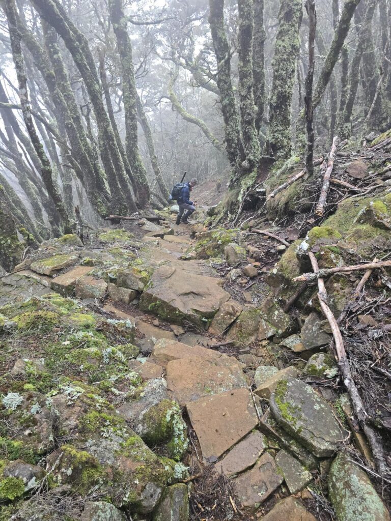
Higgs track, Western Tiers Tasmania
Public land and river maps
If you missed it on our Instagram, we are in the process of creating a series of public land and river maps which are being uploaded on our website here. They are designed to help anglers find new destinations off the beaten track, and should be used in combination with the Inland Fisheries Service Angler Access maps and advice on access.
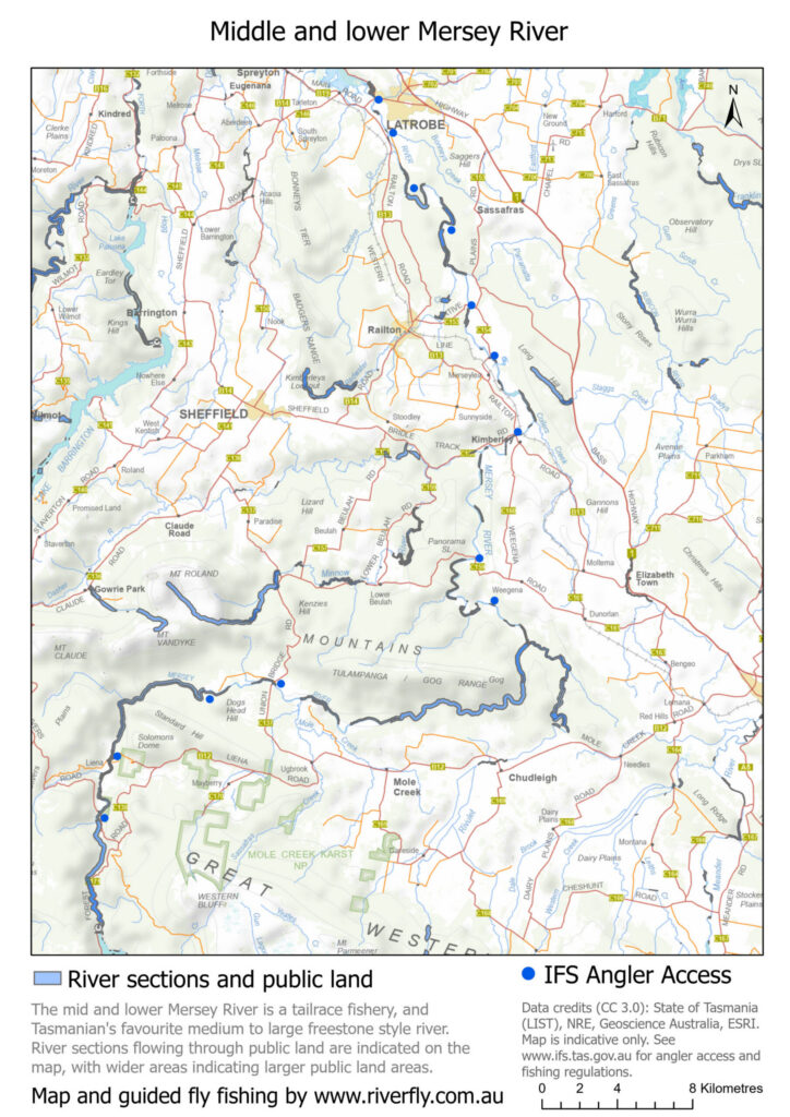
Mersey River fly fishing and public land map